Fencing near the river: what the sources say, side by side
A fence near the Murray or in a flood area can need a permit, and what applies depends on the side of the Murray, the overlay or zone, and who owns the land next to you. This page sets out each side separately, and labels any guideline written for another region. The boundary-fence rules are on two other pages: the Victorian side and the New South Wales side.
Victorian side of the Murray: flood overlays and planning permits
Mildura Rural City Council says its planning scheme Amendment C106mild updated the Floodway Overlay and the Land Subject to Inundation Overlay using Mallee CMA flood mapping (Amendment C106mild). The page gives no date and does not mention fences. Planning Victoria's undated guidance on the Land Subject to Inundation Overlay says "A permit is generally needed to construct buildings or works", lists fences among works needing a permit, and states an exemption "To post and wire and post and rail fencing" (Planning Victoria guidance). It also says a schedule can remove the permit requirement, and that applications must be referred to the floodplain management authority unless agreed conditions are met.
We did not check whether the Mildura schedule changes any of this, so we cannot say a post and wire fence on your land is exempt. Ask the council's planning department, and look up your overlay on VicPlan. Fences may also need a building permit (Mildura building permits).
Another region's flood fencing guidelines
We could not read any Mallee CMA fencing guidelines. Two other catchment authorities, North Central CMA and Wimmera CMA, have published guidelines for flood-prone land (North Central CMA, another region's guideline, Wimmera CMA, another region's guideline). They are another region's guidelines, not rules for Mildura. They say fences on flood-prone land usually need a council planning permit, and also: "We advise against installing wire mesh or rabbit proof (netting) fences in flood prone areas."
They describe flood-friendly types, labelled A to F, from drop or lay-flat fences through wide-spaced post and wire, with posts at least 2 to 3 m apart, to posts and rails with at least 150 mm bottom clearance. One or two electric wires are allowed under type A. Fences should run parallel to the flow and avoid crossing the main floodway. On the Victorian side of the Murray, ask the council whether anything like this applies.
Victorian side of the Murray: waterways permits and the flood record
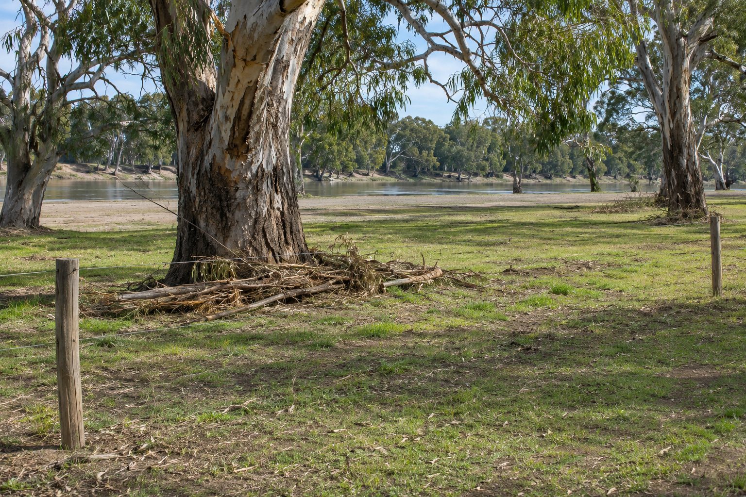
Mallee CMA offers floodplain advice by form and says "Work in designated waterways generally needs a permit", a Works on Waterways Permit (Mallee CMA floodplain advice). Its Waterways Protection by-law requires a permit to "construct, alter, remove, obstruct or interfere with any structures or works in, under, on or over a designated waterway", and also does not mention fences or the Murray (Mallee CMA by-law). Whether the Murray is a designated waterway, and whether a fence counts as works, we could not establish: ask Mallee CMA. The council's permit to interfere with watercourses or related infrastructure lists fences among related infrastructure (council permit listing). Ask whether your fence is affected.
Victoria SES says the last significant riverine flood at Mildura occurred in 1956 and flash flooding is the higher risk (Victoria SES). A newspaper reported the Murray rising in January 2025 (Sunraysia Daily, news). That is reported, not verified, and gave no flow figures.
Native vegetation: a rule on each side
On the Victorian side of the Murray, the Victorian Government says planning schemes may allow clearing to construct or maintain boundary fences without a permit, and tells landholders to check with the planning department of their local council. Clearing on the public land side of your fence needs written consent from the public land manager (native vegetation exemptions).
On the New South Wales side of the Murray, the NSW Government allows clearing for rural infrastructure including fences if it supports genuine agricultural use, and says "You must only clear the minimum amount of vegetation necessary" (NSW allowable activities). Maximum distances depend on the zone, and we could not establish which zone applies to Wentworth Shire, so we publish no distances. Ask Wentworth Shire Council.
New South Wales side of the Murray: exempt development and the flood study
Wentworth Shire's flood study covers riverine flooding at Wentworth, Pomona, Curlwaa, Dareton, Buronga and Gol Gol and sets no development controls (Wentworth flood study). A statewide fact sheet on exempt and complying fences, dated January 2022 per the copy we found and hosted by Wentworth Shire Council, does not mention Wentworth (NSW fences fact sheet). For rural and environment protection zones it says fences must not be higher than 1.8 m, must be post and wire or post and rail, may use masonry only within 3 m either side of the entrance, must follow AS/NZS 3014:2003 if electric (we have not verified that standard's current status), and must be non-combustible or hardwood on bushfire-prone land.
It says exempt fences are not allowed in foreshore areas or on flood-control lots, but lists that under other zones, so check the exact scope with the council, and not on land with a heritage item. The NSW Planning Portal adds that exempt development cannot generally be carried out on State Heritage Register land (Planning Portal fences). A fence that fails the exempt standards may qualify as complying development.
Crown land, the border and channels: the two sides compared
This is the one place we set the two Acts side by side. Each cell comes from its own source.
| Point | Victorian side of the Murray | New South Wales side of the Murray |
|---|---|---|
| The Act | Fences Act 1968 (version 072) | Dividing Fences Act 1991 (version dated 7 December 2024) |
| A Crown or public land neighbour | Section 31 says the Act, with s30H, "shall not apply to any unalienated Crown lands". | Section 25(1) says the Act "does not operate to impose any liability, or to confer any rights, with respect to dividing fences on" listed Crown and public land, including the Crown, a council and a trustee of a public reserve or park. |
| A public authority neighbour | DEECA says the government is not liable for any maintenance, or contribution towards fences that adjoin Crown land (DEECA factsheet). | Legal Aid NSW says a public authority such as a council, Housing NSW or a public school "doesn't have a legal responsibility to share the cost" (Legal Aid NSW FAQs). |
On the Victorian side of the Murray, Crown water frontages have their own rules: frontages are "subject to licence, and not to a lease", and licences "do not provide an exclusive right or use" (frontage licensing). A 2021 Victorian Government FAQ says the cost of a fence is the landowner's responsibility, proposed fencing alignments must be approved before installation, fences built without approval may be rebuilt at the adjacent landowner's expense, and pedestrian access must be provided at any fence that crosses a frontage (frontage FAQs). Neither page names the Murray, so we do not say they apply to it. On the New South Wales side of the Murray, an undated Law Society note says a Western Lands lease holder is responsible for boundary fencing in a stock-proof condition; whether your block is Western Lands is for NSW Crown Lands to say.
The Murray is the state border. Wikipedia, a secondary source (Murray River article), says it lies along the top of the southern (Victorian) bank, and survey agencies agreed "the precise line of the border" at Mildura in September 2022, with formal survey and marking still to follow (border survey update). No source we found says what either boundary Act does for a fence along or across the river, so ask the regulator for the side where your fence is. For irrigation channels, the fact sheets we read say nothing about fences or channel reserves: ask Lower Murray Water. Local pages: Mildura, Robinvale and Buronga and Wentworth. See also the vineyard and orchard fencing page, or send your town and a photo of the line.
What this page cannot do
This page cannot tell you whether your fence needs a permit. We could not check the Mildura schedule to the flood overlays, whether the Murray is a designated waterway, Mildura's own fence permit thresholds, or which vegetation zone covers Wentworth Shire. The flood guidelines were written for other regions. We are a referral service: we pass your enquiry to local contractors. For permits, ask the council on the side of the Murray where your fence is.
Check the current rules before you rely on this
This page describes council, catchment and Crown land points for fences near the Murray, with each rule tied to its side of the river. It describes the rules in general terms as they stood in November 2026. Standards, forms, thresholds and fines change.
The authoritative sources are Planning Victoria, Land Subject to Inundation Overlay (practice note, undated), North Central CMA, fencing guidelines for flood-prone areas (2020; another region's guideline), Mallee CMA, floodplain advice and works on waterways, Wentworth Shire Council, fences: rules for exempt and complying development (NSW fact sheet, January 2022, statewide), NSW Government, native vegetation allowable activities and Victorian Government, licensing and fencing FAQs for Crown water frontages (2021). Where anything here differs from those sources, they are right and we are not.
We are not fencing contractors, builders, regulators or lawyers. For what applies to your fence, ask Mildura Rural City Council (03 5018 8100) or Mallee CMA on the Victorian side of the Murray, and Wentworth Shire Council (03 5027 5027) on the New South Wales side.
Accurate at the time of writing, November 2026. Always check the source before relying on it.